The View from 700 Kilometers: Satellite Archaeology and the Hidden Edges of Mohenjo-daro
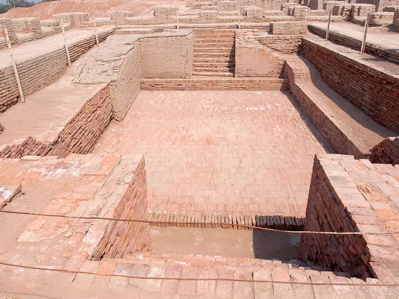
Mohenjo-daro is usually imagined from the ground: brick lanes, a great bath, a citadel mound rising above the Indus plain. Yet some of the most important recent work at the site begins far above it. From declassified Cold War satellites to modern radar instruments and drone-mounted cameras, remote sensing is allowing researchers to examine buried streets, ancient channels, and the city's forgotten edges without excavation. For a site as fragile as Mohenjo-daro, that is not merely a technical convenience. It is a conservation strategy.
Why Look Down Before Digging
Mohenjo-daro is a UNESCO World Heritage Site, and its condition is under constant pressure. Salinity, groundwater, monsoon flooding, wind erosion, and the simple weight of visitors all threaten the mud-brick and baked-brick remains. Large-scale digging is therefore not a casual option. Every excavation removes material and exposes structures to new hazards.
Remote sensing offers an alternative first step. Instruments carried by satellites and aircraft can detect differences in soil moisture, vegetation growth, surface temperature, and subtle elevations that often reflect what lies beneath the ground. Archaeologists call these traces proxies: indirect signals that must be interpreted carefully, but which can guide research and conservation planning before any trowel is lifted.
Reading the Past in Pixels and Pulses
The toolkit is varied. Historical aerial photographs, including imagery from Cold War reconnaissance satellites declassified in the 1990s, provide a baseline of the landscape before modern agriculture and settlement expanded. Those old images are especially valuable around Mohenjo-daro, where the Indus plain has been repeatedly reshaped by irrigation, flooding, and cultivation.
Multispectral satellite sensors add another layer. They record light beyond the visible spectrum, making it possible to distinguish healthy vegetation from stressed crops. Buried walls and compacted streets can alter how water moves through soil, producing faint patterns in fields above archaeological features. Radar satellites contribute something different: microwave pulses can penetrate dry surface material and respond to texture and moisture, while repeat passes allow researchers to measure tiny changes in ground elevation over time.
Closer to the ground, drone surveys produce detailed three-dimensional models of mounds, channels, and eroded surfaces. When combined with GPS and photogrammetry, drone imagery can resolve features at centimeter scale. Thermal cameras, meanwhile, can record how different materials heat and cool, sometimes revealing buried structures by their temperature signatures.
What the Instruments Have Found
The most consequential results concern the city's surroundings rather than its famous center. Satellite and aerial mapping have suggested that Mohenjo-daro was embedded in a denser landscape than the excavated mounds alone imply. Traces of possible field boundaries, tracks, and smaller settlement areas appear in several datasets, though each must be verified before it can be treated as fact. The city did not end abruptly at the edge of the protected zone; its economic and agricultural hinterland likely extended across the plain.
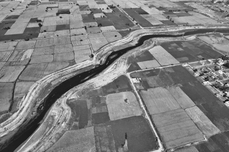
Ancient river channels are another focus. The Indus has shifted across its floodplain many times, and identifying older courses is essential for understanding how Mohenjo-daro obtained water, managed floods, and connected to trade routes. Satellite imagery has helped researchers map palaeochannels, the faint scars of abandoned waterways, across the wider region. The evidence is complex, and no single image settles the debate. But remote sensing has widened the frame from the city itself to the river system that sustained it.
Such findings also have practical value. If old channels or low-lying areas are identified near the site, conservators can better anticipate where water may collect or where erosion may accelerate. Mapping the buried landscape is therefore both an archaeological and a management exercise.
From Pixels to Virtual Tours
For virtual tours, the payoff is immediate. A digital reconstruction of Mohenjo-daro can now show not only the excavated streets but also the broader landscape inferred from remote sensing. Overlays can distinguish confirmed structures from probable features, and layers can explain how radar, multispectral, and drone data were combined. That transparency matters. A virtual visitor should be able to see the difference between a surveyed wall and a suspected buried street.
Mohenjo-daro Online's own approach, one discovery at a time, fits this method well. Remote sensing is not a single revelation but a series of small, cumulative observations. Each satellite pass, each drone flight, and each historical photograph adds a piece to a map that is still being drawn.
Limits and Ground Truth
Remote sensing is not magic. Buried features can be ambiguous, and modern plowing, irrigation, and construction can mimic ancient patterns. Interpretations require ground checks, local knowledge, and cautious comparison with excavated evidence. Nor can satellites replace the study of bricks, seals, bones, and seeds. They change the scale of the questions, not the need for careful scholarship.
Still, the view from above has altered how archaeologists think about Mohenjo-daro. The city is no longer only a set of mounds to be dug and displayed. It is a node in a living, shifting plain, and the instruments above it are helping to reveal that larger story without disturbing the fragile ground below.